
Missions
Every Mission Starts with a Plan

In The Field
Infrastructure & Aerial Services
Aerial documentation and condition support for the infrastructure that rural communities and utilities depend on. Whether it’s a bridge deck, a cell tower, a stretch of power line, or a roof that nobody wants to climb, we plan the mission around what the job needs.
Structural Inspections — Bridges, overpasses, culverts, towers, and rooftops. Close-range visual and thermal capture at the detail level. Bolts, welds, cracks, seams, hardware connections.
Utility & Energy — Power lines, solar arrays, substations, and rural electric infrastructure. Thermal and visual documentation for condition assessment and maintenance planning.
Communication Infrastructure — Cell towers, repeater sites, and related equipment. Vertical orbits, grid-pattern capture, and detailed structural documentation.
Property & Aerial Imaging — Fence lines, ag land, property documentation, development projects, real estate and general aerial photography.


Behind the Lens
Aerial Photography & Media
Skyscout provides aerial photography and video for real estate, development, and commercial clients who need professional imagery without the overhead of a full production crew.
Real Estate & Property Photography — Listing photos, property overviews, neighborhood context, and flyover video for agents and developers.
See a client property we photographed
Commercial & Project Documentation — Construction progress, site documentation, promotional content, and anything that benefits from a clear view from the right angle.
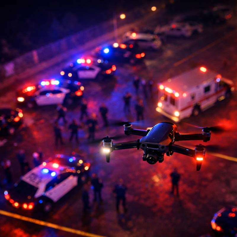
Emergency Operations
Public Safety & Emergency Operations
UAS support for public safety agencies operating in rural and regional environments. We integrate within Incident Command structure and operate as a contracted asset.
Fire Support — Thermal hotspot detection, wildland fire perimeter monitoring, post-burn structural assessment, structure fire thermal checks, and real-time thermal feed to incident command.
Law Enforcement & SAR — Thermal search grids, night search support, overwatch documentation, and evidence scene documentation.
Drone as First Responder — Rapid aerial deployment for situational awareness before personnel arrive on scene.
Airspace Authorization
COA & Waivers
Our pilots maintain the appropriate FAA authorizations required for the work we do. When a mission requires a Certificate of Authorization or Part 107 waiver, we handle the planning and coordination so your agency or department doesn’t have to.
Authorizations we hold or pursue as needed:
- Night operations (Part 107.29)
- Operations over people (Part 107.39)
- Controlled airspace access (Part 107.41)
- Beyond Visual Line of Sight (BVLOS)
- Temporary Flight Restrictions (TFR) coordination
- Emergency COA requests for public safety operations
What this means for you:
- No airspace paperwork on your end
- Mission planning accounts for authorization lead times
- All flights are conducted in full FAA compliance
- LAANC authorization used where available for faster access
- Emergency COA requests can be expedited for active public safety incidents.